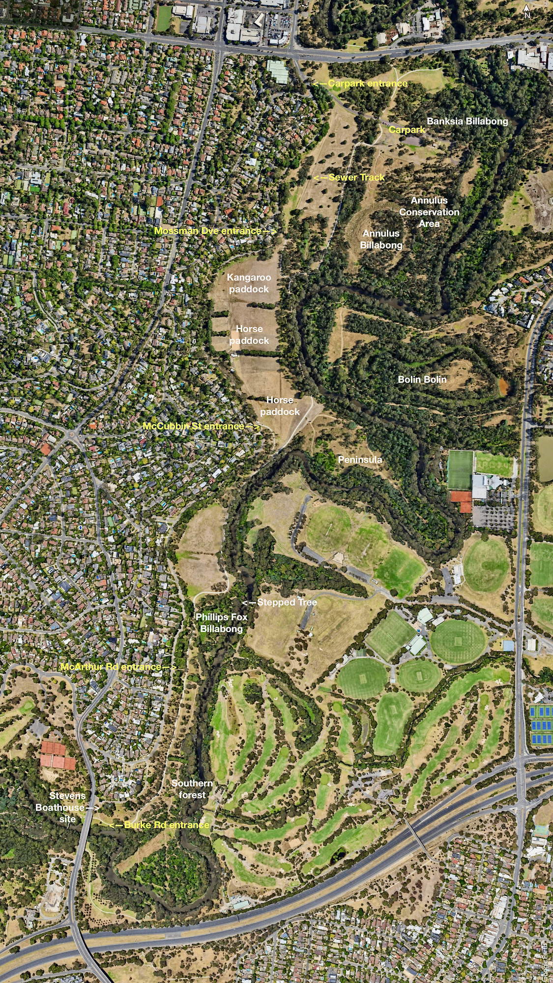
Yarra Flats Park is 3km long and has the Main Yarra Trail running down its length.
There are 7 main entrances to the park.
At the very north end are a path from Banksia St. (not often used) and the Main Yarra Trail which goes under Banksia Street (at the bridge over the Yarra).
Then there is the carpark just south of Banksia St. with the road to this off The Boulevard.
Down the length of the park are 4 entrance paths that are marked on the map.
The Boulevard runs down the western side of the park and is suitable to walk along if you want to do a circuit.
The Yarra is the eastern boundary of the park.
There is a poorly maintained shelter near the carpark and a closed toilet block - Parks Victoria do not want to spend any money to do these up.
There are 2 drink taps on the Main Yarra Trail - one at at the carpark, and the other adjacent to the Peninsula.
See this map full size in a new window.

